Walking direction Scharnitz to Reith
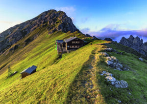
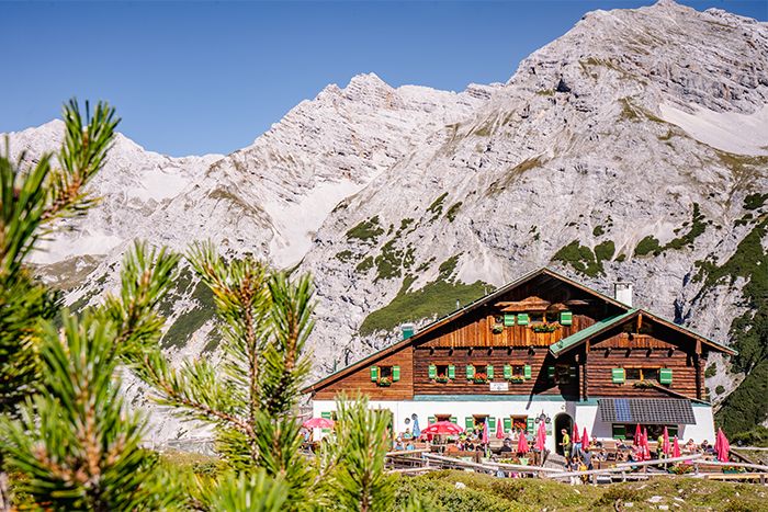
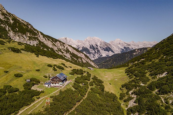
Pfeishütte – Solsteinhaus
Stage 3 – Day 4
Pfeishütte – Solsteinhaus
Between wilderness and settlement area
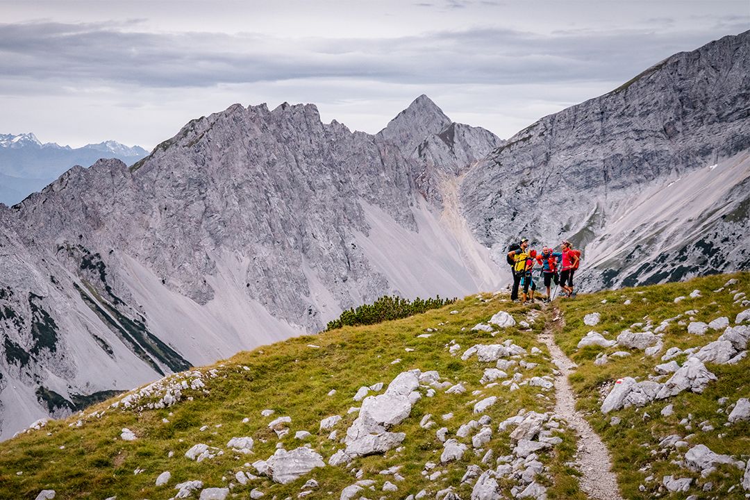
To overcome this stage, the longest in duration on the Karwendel High Alpine Trail, it is best to leave the Pfeishütte bright and early. As you start out, you will be able to enjoy the morning quiet of the mountain range and you may even see some of the creatures that live up in the hills.
- Starting point: Pfeishütte
- Endpoint: Solsteinhaus
- Highest point: 2314 m
- Recommended equipment: ankle-high mountain boots, light crampons or spikes, telescopic poles, plenty of water
- Difficulty: difficult / black mountain trail
Difference in altitude uphill
1400 m
Distance
16,5 km
Difference of altitude downhill
1550 m
Duration
9:00 h
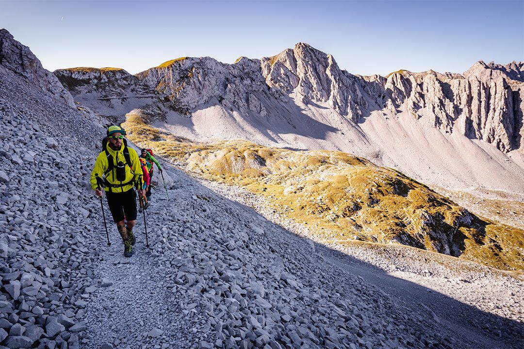
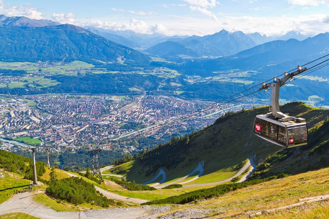
The third and longest stage (in duration) of the Karwendel High Alpine Trail leads the mountaineers along the Goetheweg and the Gipfelstürmerweg from the Pfeishütte to the Solsteinhaus. The intense contrast between the wild and rugged Karwendel massif and the populated Inn valley becomes very clear here. As this is a very long and demanding stage, you should probably consider taking a break in the enchanting city of Innsbruck, the capital of Tyrol, which scores with a unique alpine and urban mix of mountain and valley, nature and city. Unique in the world, you can reach the city with the golden roof in 20 minutes from the Seegrube mountain restaurant.
Route description:
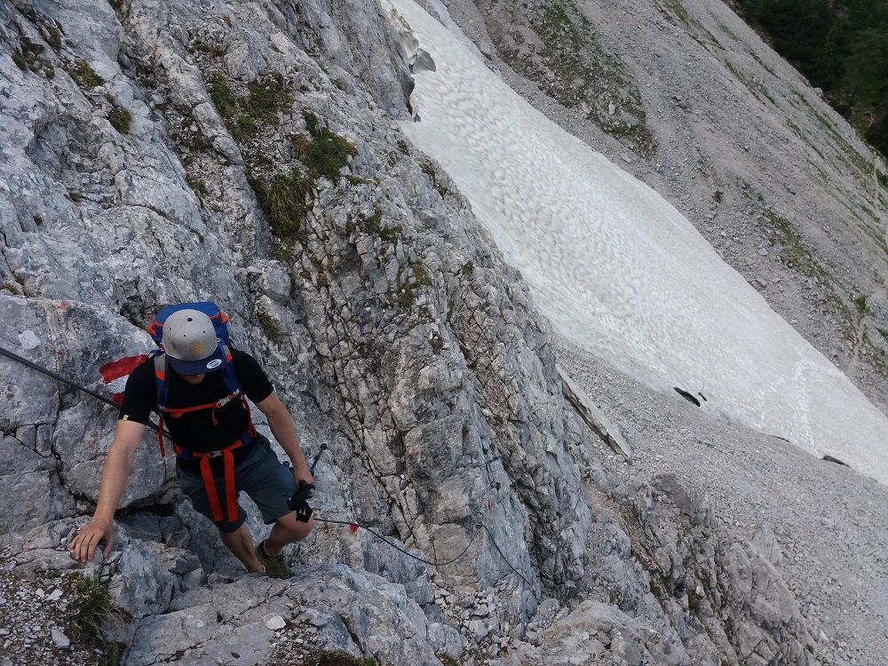
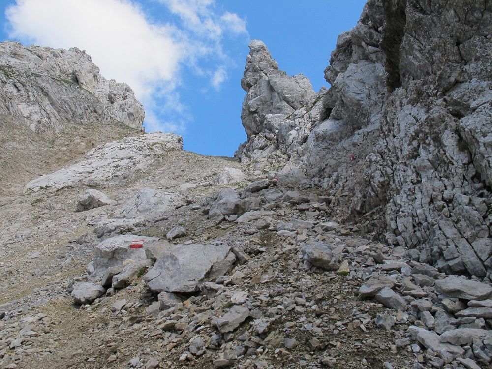
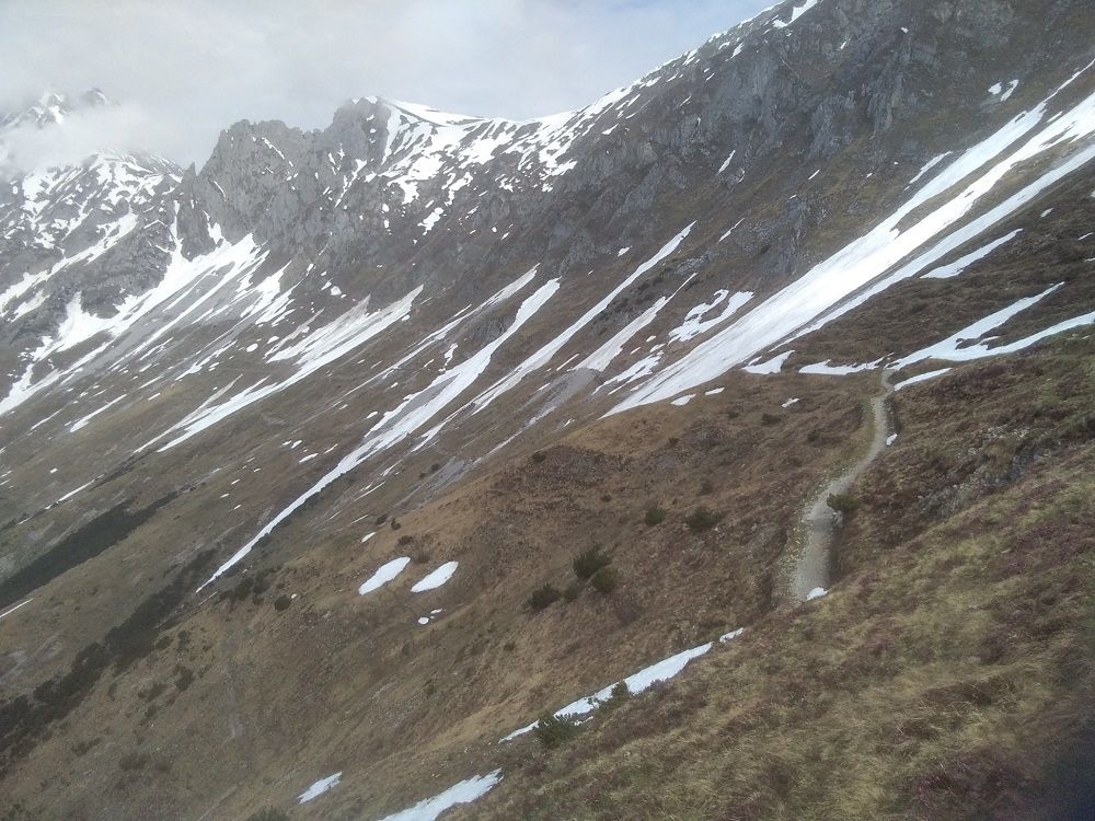
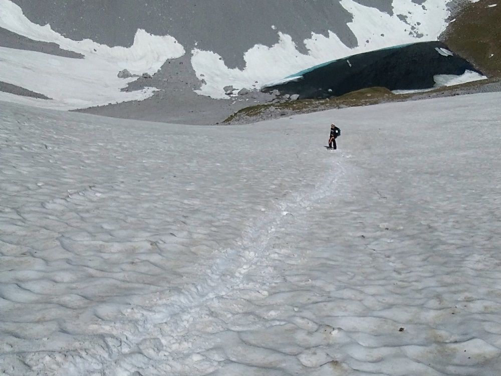
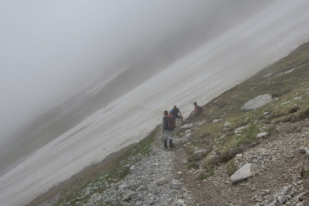
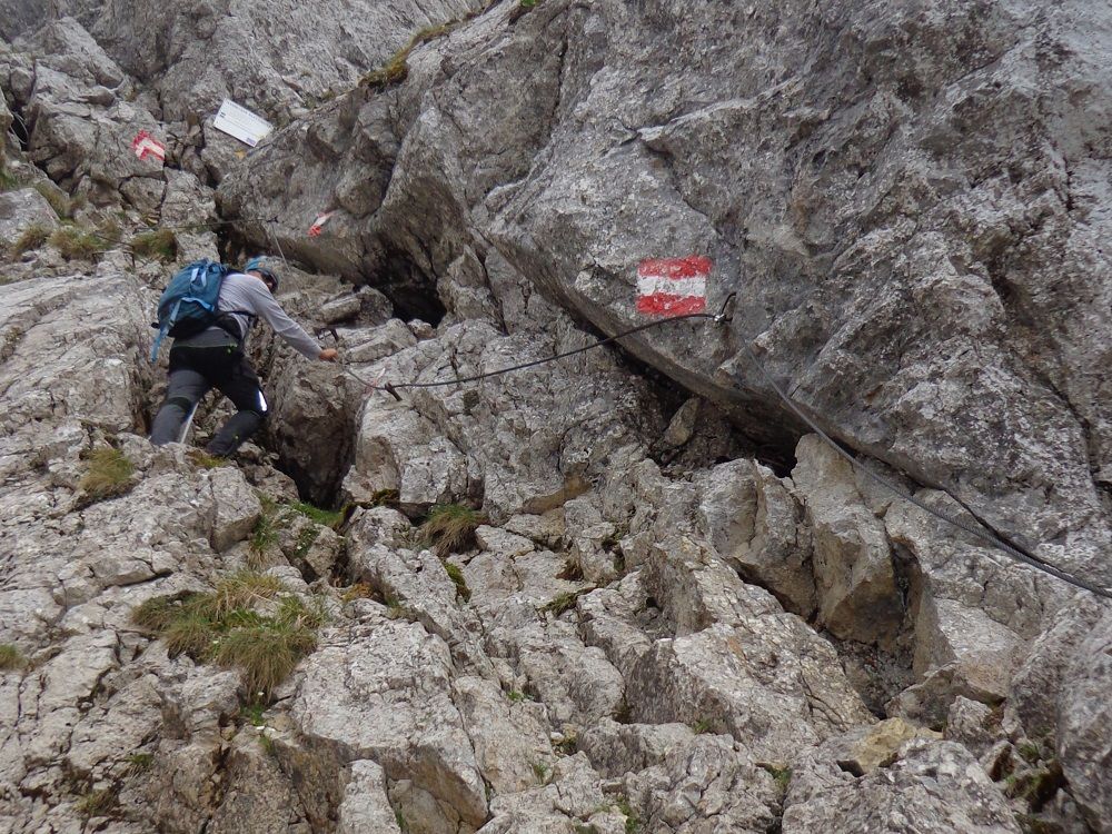
The first part of the route from the Pfeishütte is along the Goetheweg (219), first heading south and then west through mountain pine fields and through a scree field up to the Mandlscharte (2314 m). From the Mandlscharte the path descends briefly over serpentines and finally in slight ups and downs to the Mühlkarscharte. From the Scharte, the view changes to the south side of the Nordkette and offers far-reaching views deep into the Inn valley and towards the main Alpine ridge. One follows the Goetheweg over the Gleirschjöchl until we finally reach the top station of the Hafelekarbahn cable car (2269 m) south below the Hafelekarspitz. From here you walk on the trail 216 down to the Restaurant Seegrube (1906 m). From the Seegrube we keep heading west and cross beautiful mountain meadows with deep views of the city of Innsbruck until we reach the Frau Hitt saddle. The striking rock needle of Frau Hitt is located east of us and according to a legend is supposed to represent a woman on a horse. ATTENTION: Until early summer there can be a lot of old snow in Frau Hitt Kar, which is hard as a pimple in the morning (danger of falling: light crampons or spikes and poles offer optimal protection). Over insured passages it goes now over the Gipfelstürmerweg steeply down through the Frau Hitt Kar, after which it goes briefly again uphill on the so-called “Hippen”. From here we cross the Arzler Kar and climb up again to the “Sandegg”. In serpentines the path leads down the ridge, past the hunting lodge in the Wilde Iss. At the turn-off in the “Wilden Iss” you follow trail 215 westwards until you reach the well-earned Solsteinhaus.
Attention: The Innsbruck via ferrata is not feasible with stage 3!
Alternative: If you want to save the 363 hm from the Hafelekarhaus to the Seegrube, you can use the Hafelekarbahn cable car.
Emergency tip:
Since this is a very long and demanding stage, in case of emergency! you can stay overnight at the Höttinger Alm. For this purpose, before the ascent to the Frau Hitt Sattel, take trail 215 towards the Höttinger Alm.
KEY POINTS ON THIS STAGE
To give you a better idea of the difficulty of the route and the demands on the climbers, you can find a picture gallery and a video with images of the key passages. Especially in poor visibility and in the presence of old snow fields it is necessary to maintain the highest concentration here or an ascent may not be possible.

Good to know:
On this stage you will enter two different worlds. On the Goetheweg to Hafelekar, your gaze constantly changes between the rugged and rocky Karwendel Mountains and the densely populated Inn Valley. The Inn Valley lies here at your feet with its many small settlements and the Alpine city of Innsbruck. But as soon as you have crossed the Frau Hitt saddle, the rugged Karwendel mountains with their breathtaking rock formations are in front of you.
Variant via the Kristenalm pasture to the Solsteinhaus hut:
- Difference in elevation: 630 m ascent, 746 m descent
- Duration: 5:00 – 5:30 h
- Distance: 15 km
- Difficulty: medium/red mountain trail
From the Pfeishütte hut (1922 m) a beautiful trail leads down to the bottom of the Gleirschtal in about 45 minutes. At the foot of the imposing rocky mountains of the Gleirschtaler-Halltal chain, the trail continues towards Möslalm pasture (If there is no more room to stay overnight at the Solsteinhaus hut or the Pfeishütte hut, the Möslalm offers a few simple sleeping places). We follow trail 221 from the much frequented Möslalm pasture (1262 m) towards Amtssäge (1223 m). After the Amtssäge a bit down until we reach the Kristenalm pasture (1348 m). From here we hike on trail 213 over beautiful alpine meadows through the Groß-Kristental, past the Erlalm pasture to the Solsteinhaus hut.


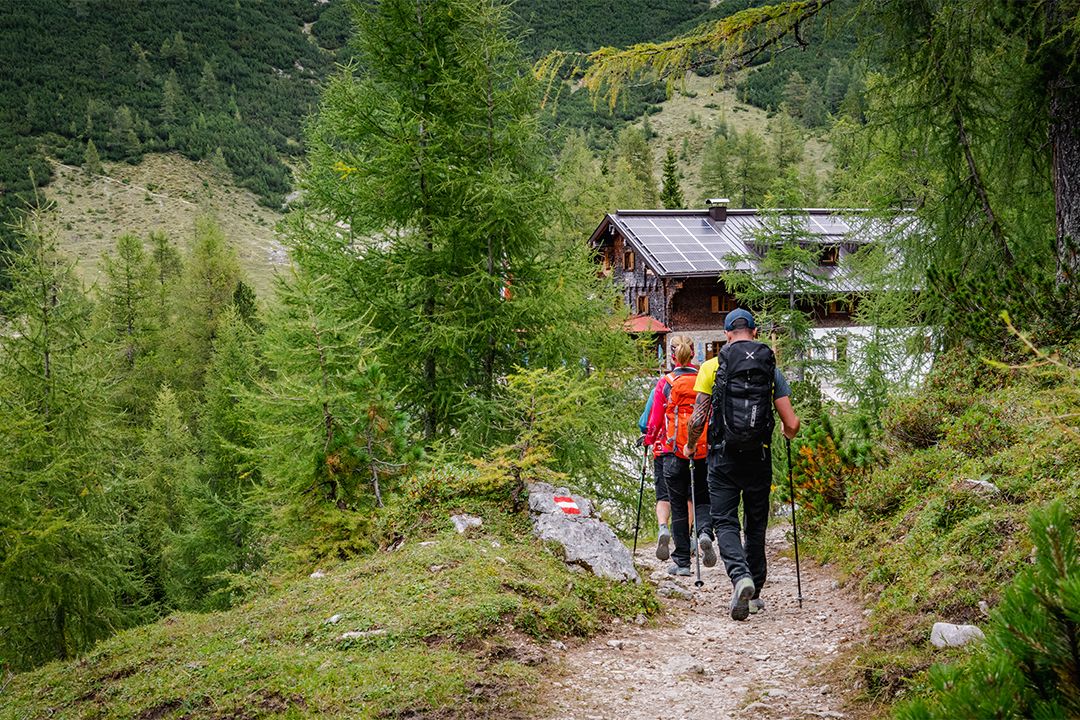
From hut to hut
Huts on this stage
It’s a long eight-hour hike from the Pfeishütte to the Solsteinhaus. You can find out what you can reward yourself with there in the hut profile.
Take a closer look!
Flora and fauna on this stage
There are typical types of plants and animals to discover on each of the six stages. The more varied the mountain terrain, the more diverse the creatures that live there.
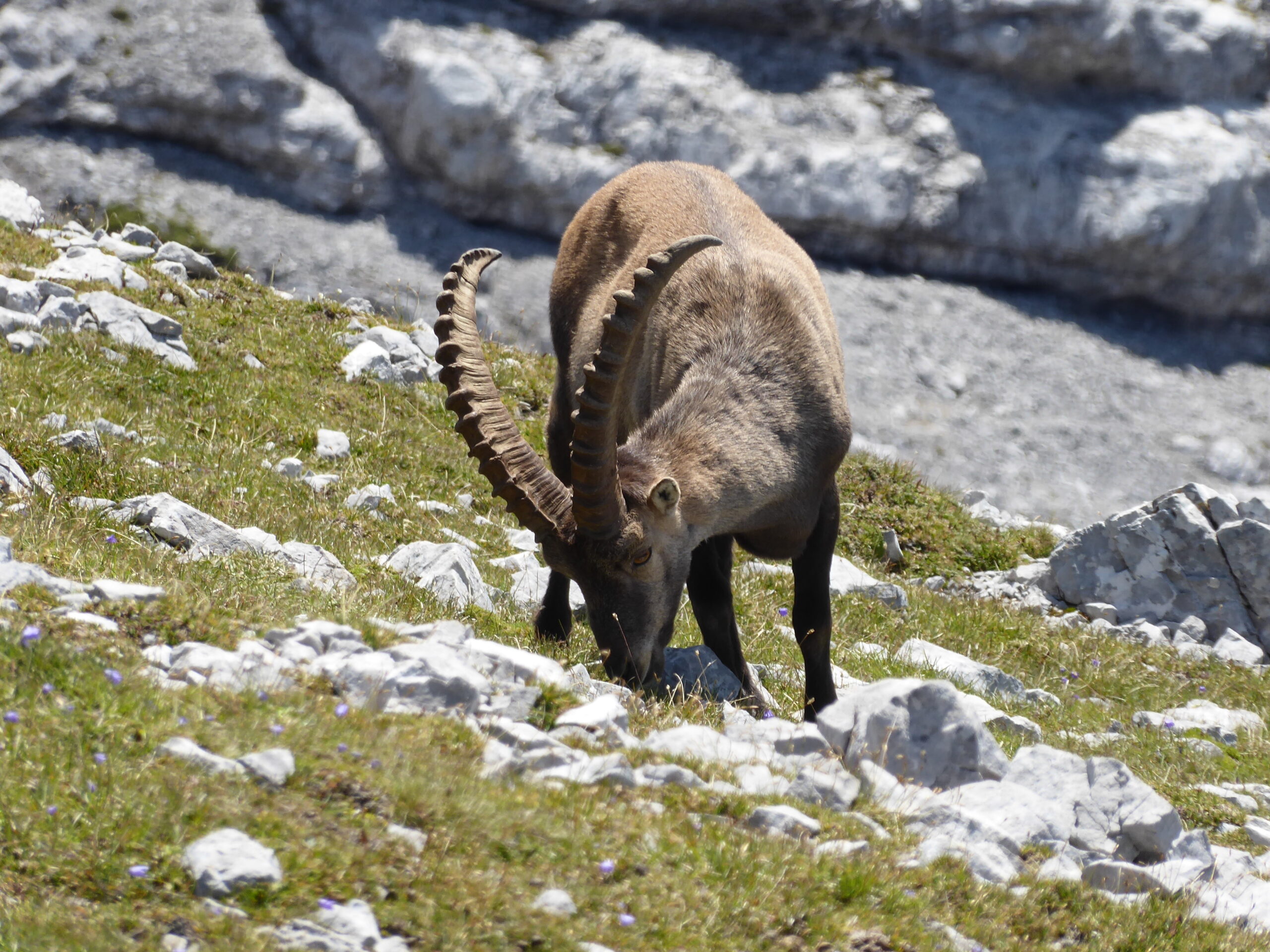
Alpine Ibex

Alpine Toadflax
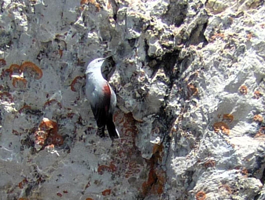
Wallcrepper

Blue-green Saxifrage

Kidney-Vetch

Snow Finch

Chamois
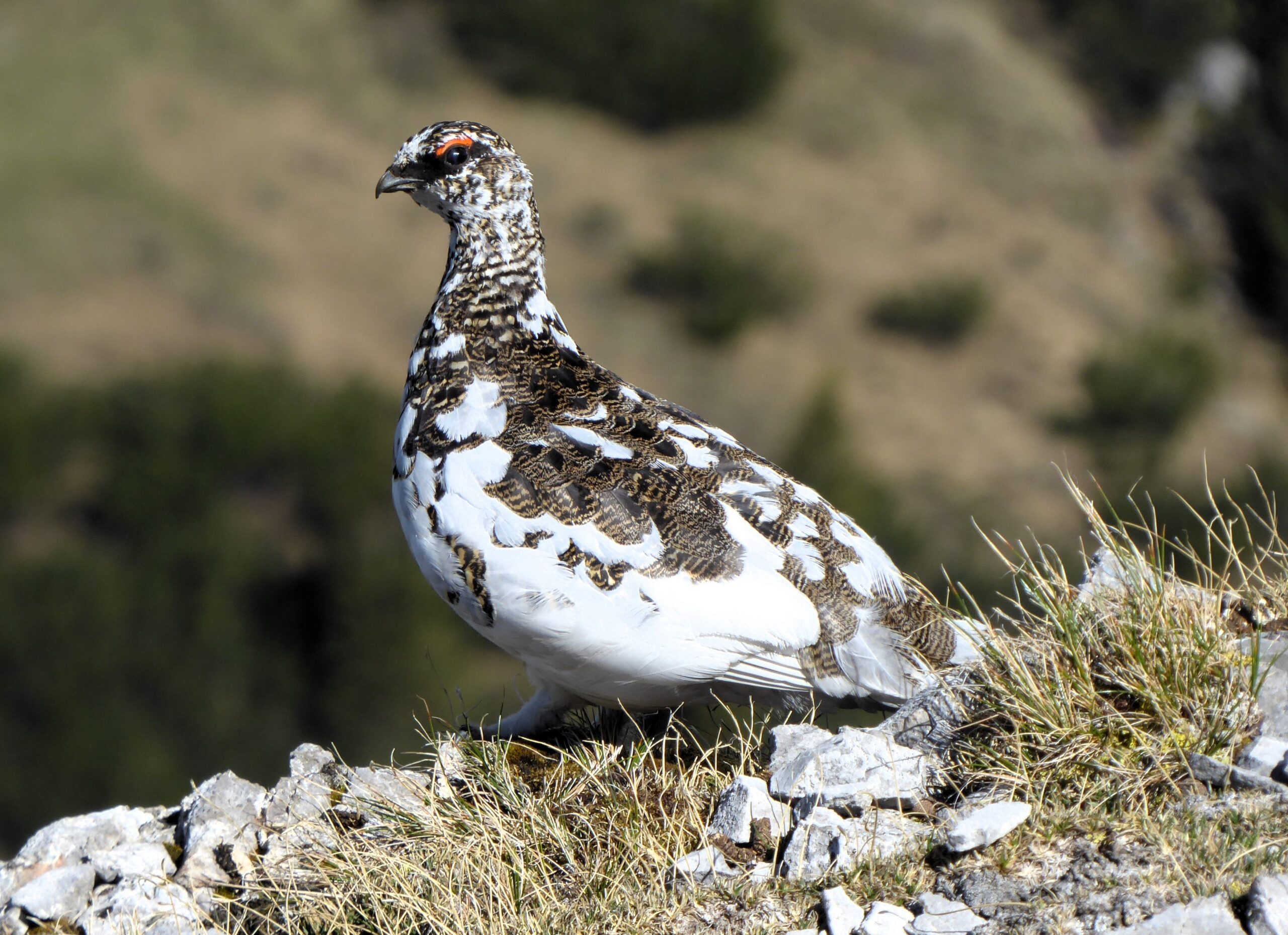
Rock Ptarmigan

Lichen Tiger

Golden Eagle
Karwendel High Trail
Further stages
On a total of six stages, Karwendel mountain enthusiasts – or those who would like to become one – get to know the Karwendel mountains in all their different facets. Mountain pine fields alternate with the typical Karwendel gravel cirques. Your gaze wanders between the barren gray of the Karwendel scree and the densely populated Inn Valley.
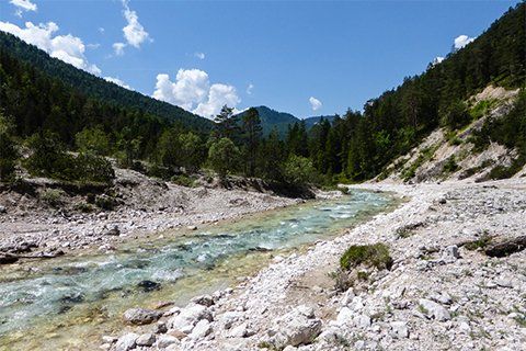
Stage 6: Scharnitz - Hallerangerhaus
The Karwendel Höhenweg starts in Scharnitz in the Länd, where the gateway to the Karwendel mountains is located. On the first day, the trail leads us through the Hinterautal valley along the turquoise-blue Isar river and finally to the wonderfully situated Hallerangerhaus.
Stage 5: Hallerangerhaus - Bettelwurfhütte
After the first day, when you have a few kilometers in your legs, you can take it easy on the fifth stage. It takes three hours to hike from the Hallerangerhaus to the Bettelwurfhütte.
Stage 4: Bettelwurfhütte - Pfeishütte
The fourth stage of the Karwendel High Trail leads from the Bettelwurfhütte over the Stempeljoch. The starting point is the Bettelwurfhütte hut perched spectacularly at the foot of the Kleiner Bettelwurf and the destination is the rustic Pfeishütte hut.

Stage 2: Solsteinhaus - Nördlinger Hütte
From the cozy Solsteinhaus, it takes around four hours to hike to the Nördlinger Hütte. This is in a wonderful location on the south ridge of the Reither Spitze.

Stage 1: Nördlinger Hütte - Reith
On the last leg, we leave from the Nördlinger Hut and reach Reith bei Seefeld train station in about three hours. We can return home comfortably by train.