Walking direction Reith to Scharnitz
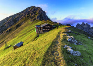
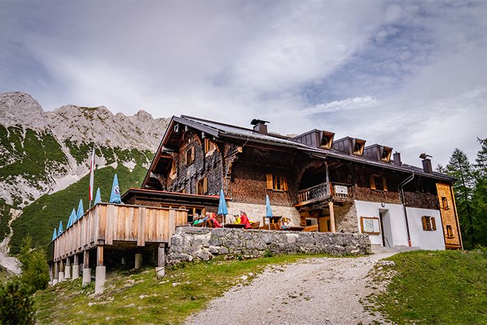
Bettelwurfhütte – Hallerangerhaus
Stage 5 – Day 5
Bettelwurfhütte – Hallerangerhaus
Top-stage with ascent of the Großer Bettelwurf peak
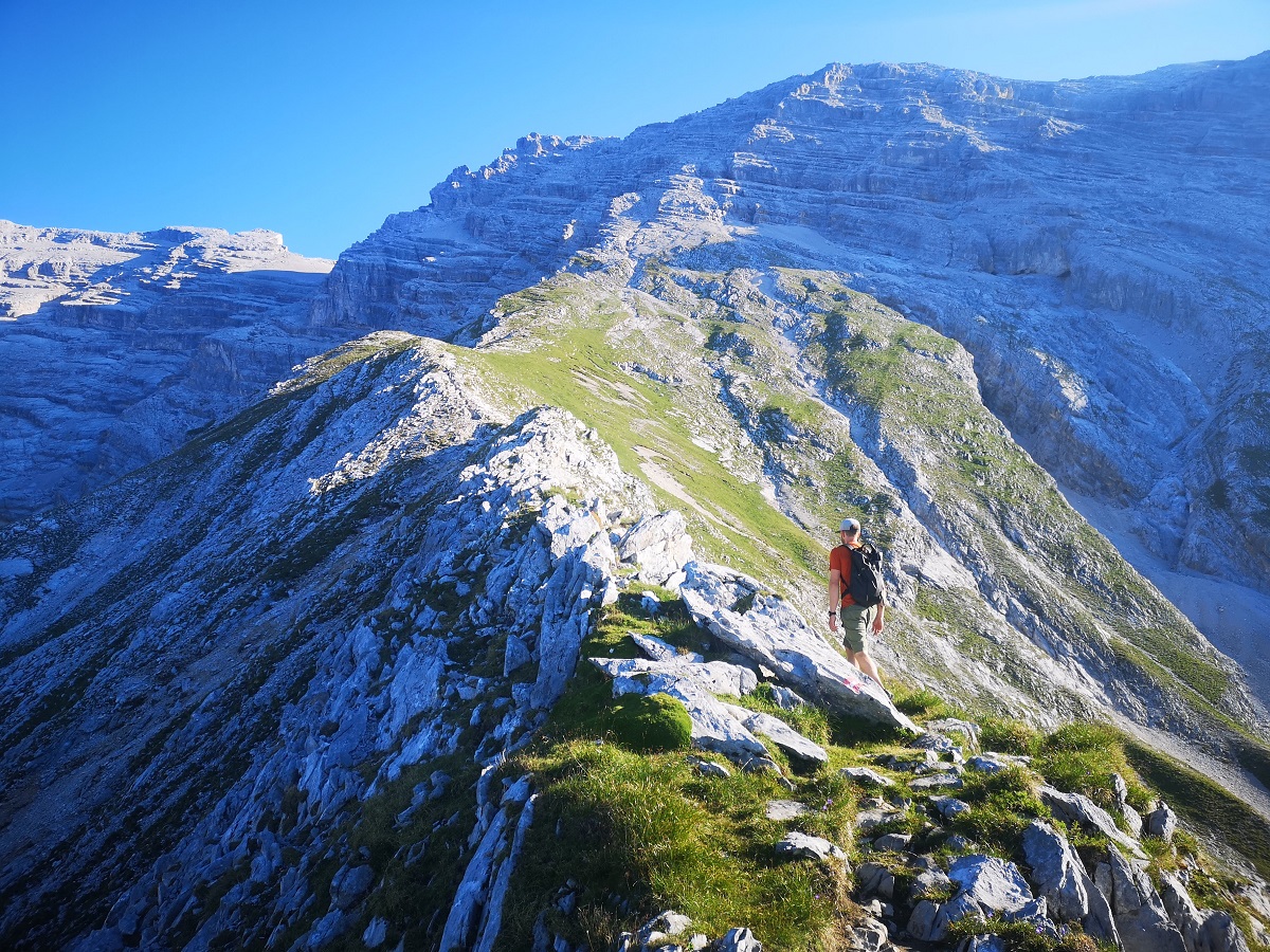
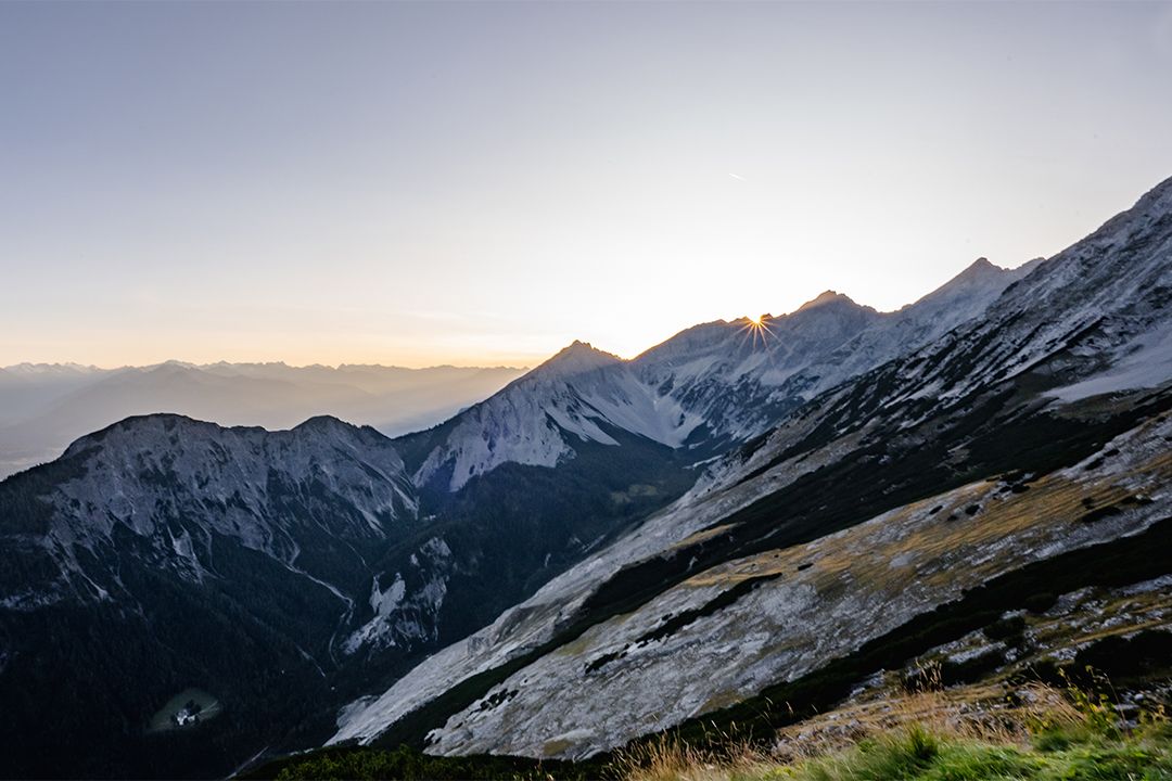
From the Bettelwurfhütte, the so-called “eagle’s nest” of the Karwendel, you will reach the highest point of the Karwendel Höhenweg on this stage, the Großer Bettelwurf peak (optional). With its proud 2726 m, it is a first-class lookout mountain and towers over the Inn valley by a good 2000 m.
- Starting point: Bettelwurfhütte
- Endpoint: Hallerangerhaus
- Highest point: 2726 m
- Recommended equipment: ankle-high mountain boots, Via ferrata set for the inexperienced
- Difficulty: difficult / black mountain trail
Difference in altitude uphill
800 m
(300 m without Großer Bettelwurf peak)
Distance
9 km
(5,8 km without Großer Bettelwurf peak)
Difference in altitude downhill
1100 m
(600m without Großer Bettelwurf peak)
Duration
6:00 h
(2:30 h without Großer Bettelwurf peak)
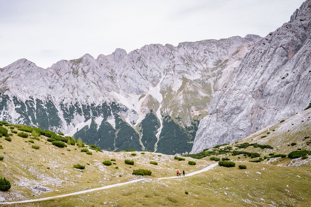
From the so-called “eagle’s nest” of the Karwendel mountains to the Grosser Bettelwurf peak (optional) with panoramic views into the Hall valley and Vomperloch. Continue over the Lafatscher Joch to the final stop of the day at the Hallerangerhaus.
Stage description:
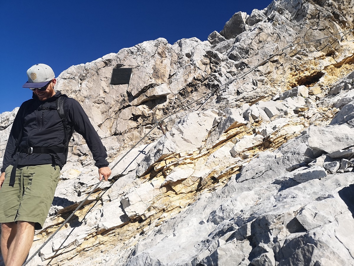
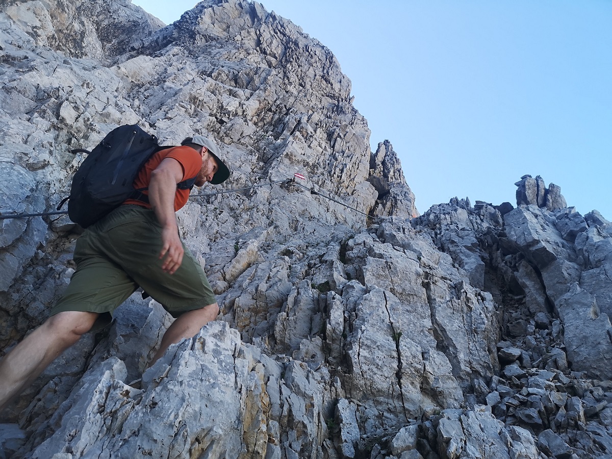
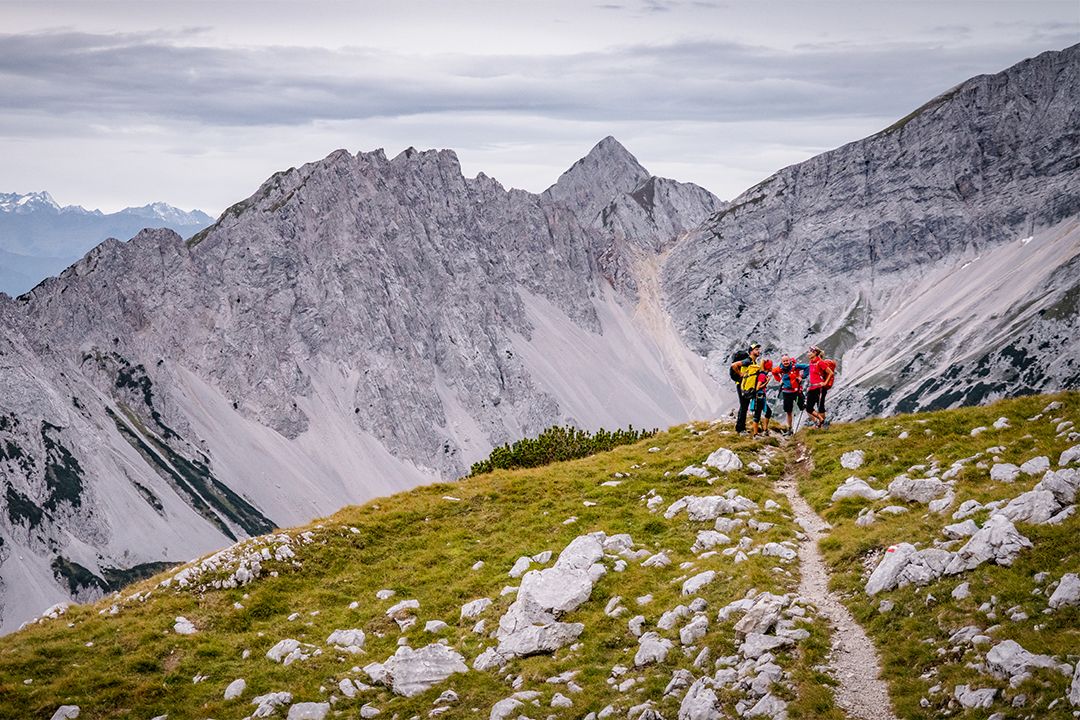
After overnighting at the Bettelwurfhütte, the mountain hut known as the “eagle’s nest” of the Karwendel mountains, those with stamina, a good level of fitness and the necessary technical equipment can opt to climb the Großer Bettelwurf peak. The route is well-signposted and heads first eastwards to where the trail comes up from the Hall valley and then continues uphill in a south-eastwardly direction to the “Eisengattergrat”, the southern ridge of the Großer Bettelwurf mountain. From there, the trail heads north and steadily upwards along the Eisengattergrat towards the summit. You will come to a rocky outcrop with the first of some wire-rope-secured passages and the section thereafter is partly-secured and partly easy climbing (I) on good-grip limestone. This leads to the summit ridge, mostly on the right of a diagonally-descending gully, and includes some partly exposed rock ledges. Via ferrata equipment, including a helmet, is strongly recommended. The path becomes steeper towards the top and splits shortly below the summit ridge and the left path, as seen from below, is easier to climb. Keep east at the summit ridge and you will reach the summit cross via a narrower ridge section that is exposed on both sides. Return to the Bettelwurfhütte via the same route.
If you choose not to attempt the Großer Bettelwurf peak, you can use the time to relax and unwind at the Bettelwurfhütte before heading off on the somewhat up and down trail 222 back to the Lafatscher Joch (2081 m) where you branch off in a northerly direction onto trail 223. This path is also part of the popular “Eagle Walk”, a wonderful long-distance hiking trail through Tyrol. The trail between Lafatscher, Rosskopf and Speckkarspitze, takes you northwards and downhill to a wide, open, gravel-filled basin and you will soon reach the area which was once blasted out for the connection between Halleranger and the Hall valley. A few more bends take you down over a gravelly section and then you carry on through a lovely wooded part until you reach the mountain hut, the Hallerangerhaus, in the heart of the Karwendel.
Key points on this stage
To give you a better idea of the difficulty of the route and the demands on climbers, you will find a picture gallery with images of the key sections here. Particularly in poor visibility and in the presence of old snowfields, it is important to maintain maximum concentration or it may not be possible to climb the route.


The legend of the begging spirit
One day, a poor salt miner came to the monastery gate of St Magdalena in Halltal and asked for alms for his hungry flock of children. Disgruntled, the gatekeeper handed him a piece of rock-hard bread. The poor man was seized with rage and shouted: ‘You can eat this beggar yourself, you miser!’ And with a powerful throw, he hurled the bread against the rock face. The nun shouted: ‘You’ll pay for that. You won’t find peace in the grave. Your spirit will have to wander restlessly in this valley.’
And so it came to pass. The man has never been seen since. He wanders back and forth invisibly in the rock faces of the Halltal valley. On warm foehn days, you can hear his howling and raving from the crevices in the rocks. The rugged, steep rock against which the salt miner had thrown the hard bread, the ‘Bettel’, was called the ‘Bettelwurf’ by the people.
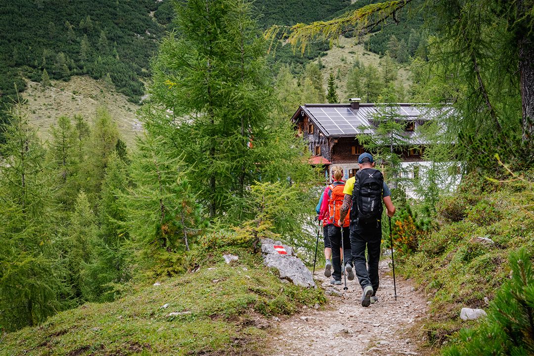

From hut to hut
Huts on this stage
Find out which hut is known as the eagle’s nest of the Karwendel and what else there is to see at the huts on the fifth stage here.

Look closely!
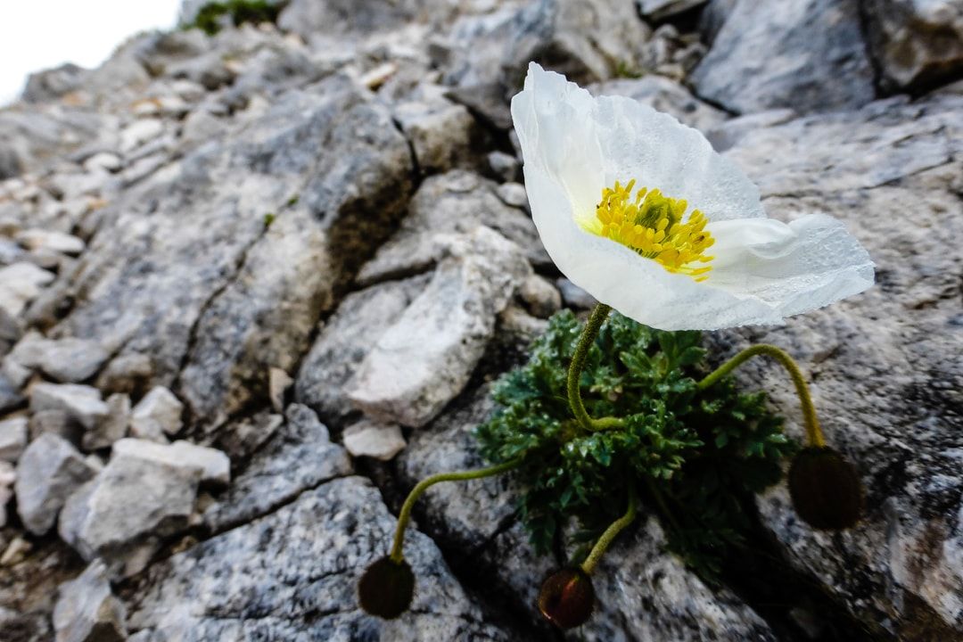
Flora and fauna on this stage
There are typical types of plants and animals to discover on each of the six stages. The more varied the mountain terrain, the more diverse the creatures that live there.

Alpine Chough

Clusius’ Gentian

Kidney-Vetch

Chamois

Fringe-flowered Gentian

Dark Vanilla Orchid

Northern Raven

Ringlet

Golden Eagle
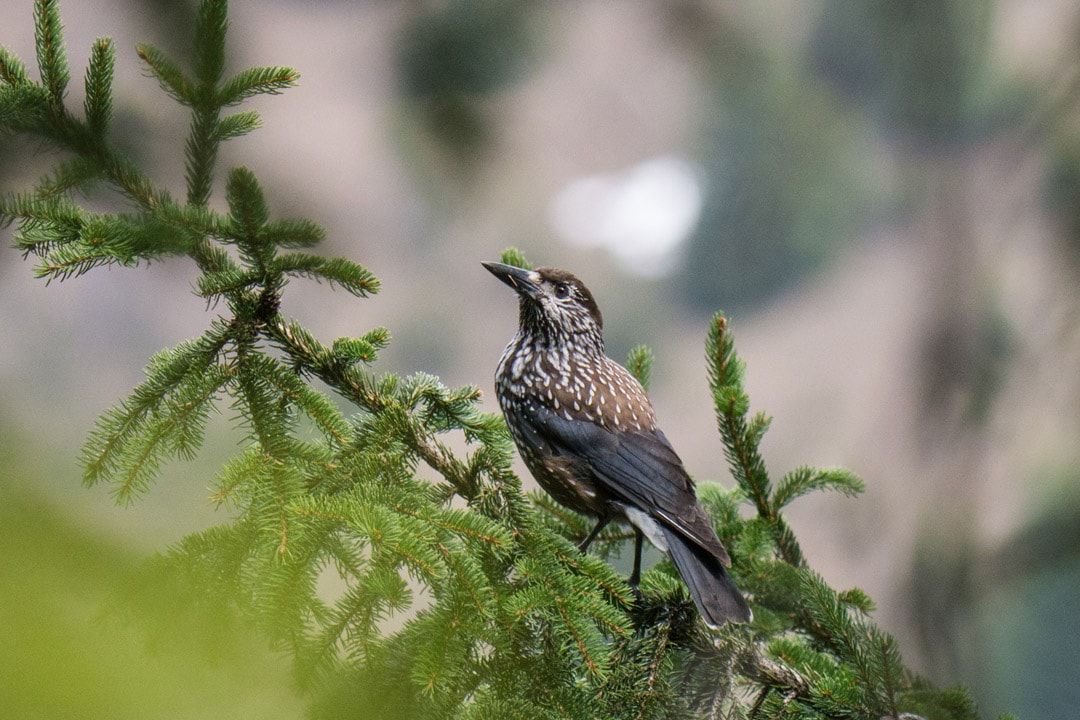
Spotted Nutcracker
Karwendel High Alpine Trail
other stages
On a total of six stages, mountain-loving Karwendel enthusiasts, or those who would like to become one, get to know the Karwendel mountains in all their different facets. Mountain pine fields alternate with the gravel cirques typical of the Karwendel. The view wanders between the seemingly barren gray of the Karwendel scree and the densely populated Inn valley.

Stage 1: Reith - Nördlinger Hütte
Before you can start from the Nördlinger Hütte towards the Solsteinhaus, you climb in this first stage from Reith bei Seefeld to the Nördlinger Hütte.

Stage 2: Nördlinger Hütte - Solsteinhaus
Via the origin saddle and the Eppzirler Scharte you follow the trail from the Nördlinger Hütte to the Solsteinhaus.

Stage 3: Solsteinhaus - Pfeishütte
On the third day you have to master the longest stage of the multi-day tour. It goes from the Solsteinhaus over the Seegrube and the Hafelekar to the Pfeishütte.
Stage 4: Pfeishütte - Bettelwurfhütte
Strengthened by the good food at the Pfeishütte, you hike over the Stempeljoch and the Wilde Bande trail to the Bettelwurfhütte.
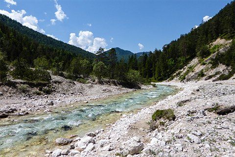
Stage 6: Hallerangerhaus - Scharnitz
From the Hallerangerhaus you descend along the wild river Isar and through the Hinterautal valley to the community of Scharnitz.